| Mapping Toolbox | |
Create a map of the United States of America
Syntax
usamap
usamap all
usamap allequal
usamap conus
usamap state
usamap stateonly
usamap('state','type')
usamap(latlim,lonlim)
usamap(latlim,lonlim,'type')
usamap(map,maplegend)
usamap(map,maplegend,'type')
h = usamap(...)
Description
usamap creates a map of all or some of the United States of America. The state or states are selected interactively from a list. A map axes and map is created in the current axes. The axis limits are set tight around the map frame.
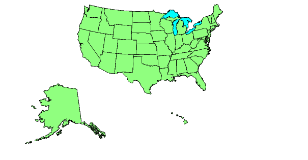
h = usamap('all') or usamap all creates a standard map of the U. S. The conterminous states, Alaska and Hawaii are each displayed as insets in different axes using projection parameters suggested by the U. S. Geological Survey. The handles for the three map axes are returned in h. h(1) contains the conterminous states, h(2) Alaska, and h(3) Hawaii.
usamap allequal creates the map with Alaska and Hawaii at the same scale as the conterminous states.
usamap conus maps only the conterminous states.
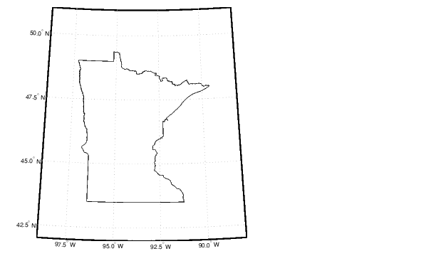
usamap state maps the requested state. Example: usamap vermont. state may also be a padded string matrix or a cell array of strings containing multiple state names.
usamap stateonly maps only that state. Example: usamap vermontonly. If any of the state names in a state string matrix or cell array of strings end with 'only', only the requested states are displayed.
usamap(state,type) controls the atlas data displayed. Type 'line' or 'patch' creates a map with atlas data of those types and text annotation of the state names. Type 'lineonly' or 'patchonly' suppresses text annotation. Type 'none' suppresses all atlas data. If omitted, type 'patch' is assumed.
usamap(latlim,lonlim) creates a map of the states covering the provided latitude and longitude limits. The limits are two-element vectors in units of degrees.
usamap(latlim,lonlim,type) is also a valid calling form.
usamap(lmap,maplegend) and usamap(lmap,maplegend,'type') use the supplied regular matrix map to define the geographic limits. The matrix map is displayed using MESHM unless type is 'none', 'lineonly', 'patch' or 'patchonly'. Use type 'meshonly' to display only the matrix map
h = usamap(...) returns the handle or handles of the axes containing the map.
Examples
Remarks
usamap uses tightmap to set the axis limits tight around the map. If you change the projection, or just want more white space around the map frame, use axis auto.
axes(h(n)), where n = 1,2 or 3, makes the desired axes current.
set(h,'Visible','on') makes the axes visible.
set(h,'ButtonDownFcn','selectmoveresize') allows interactive repositioning of the axes. set(h,'ButtonDownFcn','uimaptbx') restores the Mapping Toolbox interfaces.
axesscale(h(1)) resizes the axes containing Alaska and Hawaii to the same scale as the conterminous states.
See Also
worldmap |
Maps a country or region using worldlo atlas data |
usalo |
Returns data from the usalo atlas data file |
selectmoveresize |
Interactively select, move, resize, or copy objects |
axesscale |
Resize axes for equivalent scale |
paperscale |
Figure paper size for a given map scale |
| | usalo | utmzone | |