| Mapping Toolbox | |
Make scale the same between axes
Syntax
Description
axesscale resizes all axes in the current figure to have the same scale as the current axes (gca). In this context, scale means the relationship between axes x-and y-coordinates to figure and paper coordinates. When axesscale is used, a unit of length in x and y will print and display at the same size in all the affected axes. The XLimMode and YLimMode of the axes are set to 'manual' to prevent autoscaling from changing the scale.
axesscale(hbase) uses the axes hbase as the reference axes, and rescales the other axes in the current figure.
axesscale(hbase,hother) uses the axes hbase as the base axes, and rescales only the axes in hother.
Examples
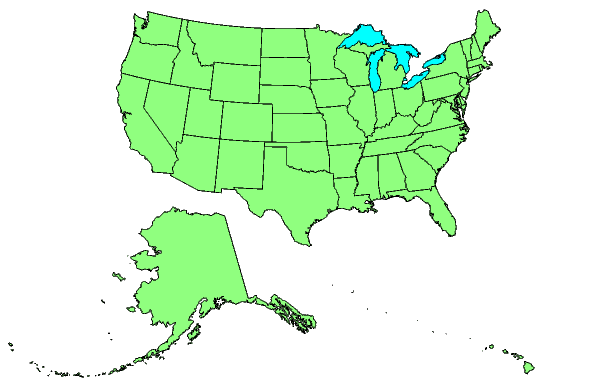
Display the conterminous United States, Alaska and Hawaii in separate axes.
hconus = usamap('conus'); tightmap

halaska= axes; usamap('alaskaonly'); tightmap;
framem off; mlabel off; plabel off

hhawaii = axes; usamap('hawaiionly'); tightmap;
framem off; mlabel off; plabel off

% Arrange the axes as desired
set(hconus,'Position',[0.1 0.25 0.85 0.6])
set(halaska,'Position',[0.019531 -0.020833 0.2 0.2])
set(hhawaii,'Position',[0.5 0 .2 .2])
Make the axes have the same scale.
Limitations
The equivalence of scales holds only as long as no commands are issued that may change the scale of one of the axes. For example, changing the units of the geoid or the scale factor in one of the axes would change the scale.
Remarks
To ensure the same map scale between axes, use the same geoid and scale factors.
See Also
paperscale |
Figure paper size for a given map scale |
| | axesm | azimuth | |