| Mapping Toolbox | |
Matrix Maps
One may represent a map as a matrix in which each element corresponds to a specific geographic area, with implied topological relationships to adjacent areas; we call such a map a matrix map. In this case, the geographic data is in matrix format, which is often called raster format. However, the Mapping Toolbox makes great use of the powerful matrix manipulation capabilities of MATLAB to fully exploit this map type, so the term matrix map is more appropriate.
When the data consists of surface elevations, the map can also be referred to as a digital elevation map/matrix (DEM) or topographical map.
As an example of this map type, consider a 180-by-360 matrix. Each row represents one degree of latitude, and each column represents one degree of longitude. Each entry of this matrix is the average elevation, in meters, for the one-degree-by-one-degree region of the Earth to which its row and column correspond. This is, in fact, the topo matrix that is provided in the MATLAB product, in the workspace of the same name.
To display the matrix map, type the following:
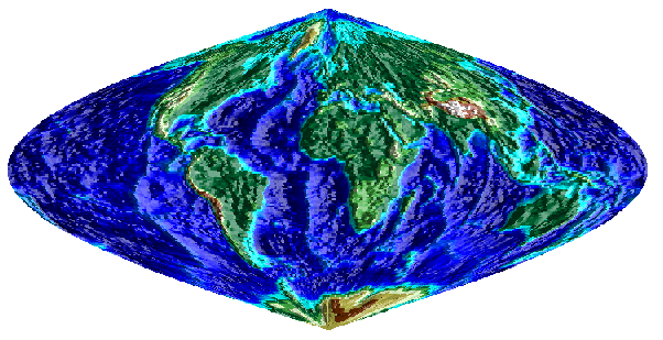
The topo matrix is displayed as a lighted, shaded relief map in a Sinusoidal projection.
Note that the meaning of the map and the projection in which it is displayed are completely independent. The topo variable is a map whether it is displayed or not, and it is the same map no matter how it is displayed, although how it is displayed can affect its interpretation.
| | Types of Maps in the Mapping Toolbox | Composite Maps | |