| Mapping Toolbox | |
Types of Maps in the Mapping Toolbox
Vector Maps
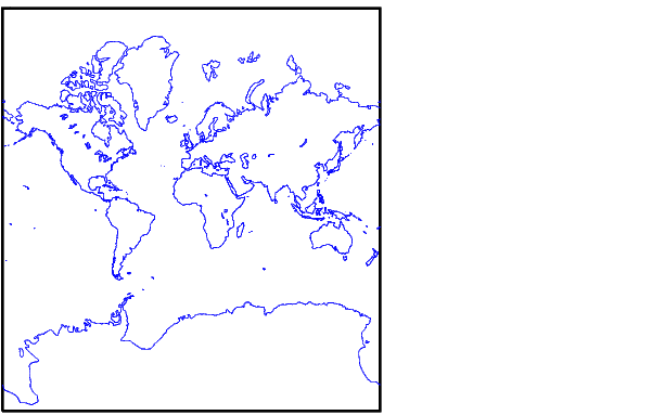
A series of latitude-longitude coordinate pairs representing, for example, points along the coast of Greenland, or along Interstate 80, or even the two sets together, form a map. In this case, the geographic data is in vector format and is referred to as a vector map. This format consists of specific points, along with some indication as to how they should or should not be connected to each other. In the Mapping Toolbox, vector data consists of sequentially ordered pairs of latitude and longitude coordinates. The pairs are considered to be connected in sequence; breaks in connectivity must be delineated by the creation of separate variables or by inserting NaNs into the sets at the appropriate break points. For vector map data, the connectivity of the data is often only a concern during display.
To illustrate a vector map, enter the following:
load coast
whos
Name |
Size |
Bytes |
Class |
|
|
|
|
lat |
9589x1 |
76712 |
double array |
long |
9589x1 |
76712 |
double array |
The variables lat and long are vectors in the coast MAT-file, which together form a vector map of the coastlines of the world.
We have chosen to view the map in a Mercator projection. A map projection displays the spherical map data in a two-dimensional plane. There are many possible ways to project a map.
| | Mapping Fundamentals | Matrix Maps | |