| Mapping Toolbox | |
Map Displays Made Easy
The Mapping Toolbox allows you to control many aspects of a map display. The majority of this chapter is devoted to the elements of a map display and the means to control them. However, the ability to control numerous properties is accompanied by the need to set them appropriately. You can trade control for simplicity by using the worldmap and usamap functions. These functions create maps of regions of the world or the United States using appropriate map projections and settings. You can then modify or add to the map displays using the methods described later in this chapter. You can also use these functions to prepare a map display without any atlas data, adding your own instead.
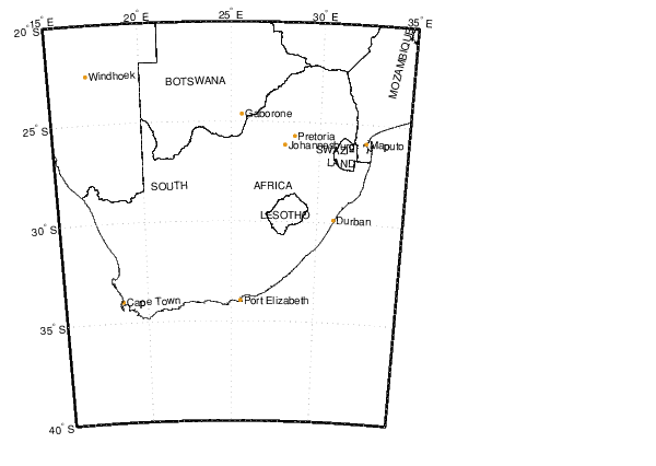
Here are some examples. Create a base map of South Africa.
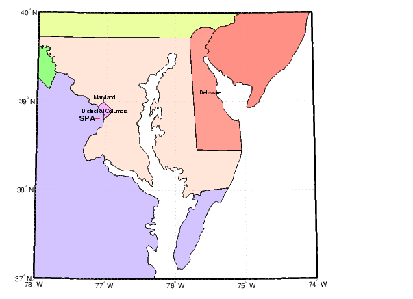
Create a map of the Chesapeake Bay using geographic limits, and add some annotation.
latlim = [37 40]; lonlim = [-78 -74];
figure
usamap(latlim,lonlim)
plotm(38.8063,-77.1312,'r+')
textm(38.8063,-77.1312,' SPA ',...
'fontweight','bold','HorizontalAlignment','r')
| | Displaying Maps | Map Axes | |