| Mapping Toolbox | |
Syntax
Background
The appearance of a map on screen may differ from the final printed output. This results from the difference in the size and shape of the figure window and the area the figure occupies on the printed page. A map that appears readable on screen may be cluttered when the printed output is smaller. Likewise, the relative position of multiple axes may appear different when printed. This functions resizes the figure to the printed size
Description
previewmap changes the size of the current figure to match the printed output. If the resulting figure size exceeds the screen size, the figure will be enlarged as much as possible.
Examples
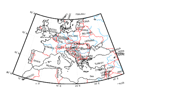
Is the text small enough to avoid overlapping in a map of Europe?
worldmap europe
h = displaym(worldlo('POtext'));
trimcart(h)
rotatetext(h)

orient landscape
tightmap
hidem(gca)
previewmap
Limitations
The figure cannot be made larger than the screen.
See Also
pagedlg |
Page position dialog box |
paperscale |
Figure paper size for a given map scale |
axesscale |
Resize axes for equivalent scale |
| | polyxpoly | project | |