| Mapping Toolbox | |
Compute latitude and longitude limits for a regular matrix map
Activation
| Command Line |
Maptool |
| limitm |
Map Contours Contours |
Description
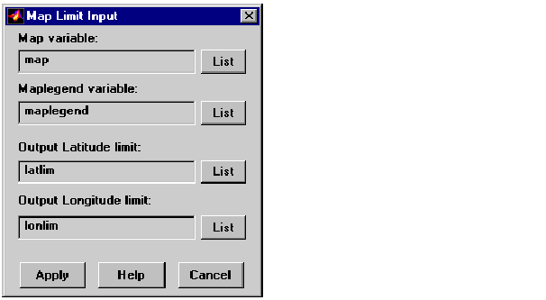
limitm activates the Map Limit Input dialog box, which allows the limits of a regular matrix map to be computed. These limits are then stored in the workspace as variables.
Controls
The Map variable edit box is used to specify the workspace variable containing the regular matrix map.
The Maplegend variable is used to specify the workspace variable containing the matrix map legend. A three-element map legend vector, enclosed in brackets, can be entered instead of a variable name.
The Output Latitude limit edit box is used to specify the name of the variable that stores the computed latitude limits of the matrix map. If this variable name already exists in the workspace, it is overwritten.
The Output Longitude limit edit box is used to specify the name of the variable that stores the computed longitude limits of the matrix map. If this variable already exists in the workspace, it is overwritten.
Pressing the List button produces a list of all current workspace variables, from which the map, maplegend, output latitude, and output longitude variables can be selected.
Pressing the Apply button calculates the limits of the matrix map and stores the results in the specified output variables.
Pressing the Cancel button disregards any input data and closes the Map Limit Input dialog box.
See Also
limitm
| | lightm | linem, plotm, plot3m | |