| Mapping Toolbox | |
Importing High-Resolution Atlas Data
In addition to the atlas data provided with the Mapping Toolbox, you can import a number of high-resolution datasets that are available over the Internet or on CDs. Important examples of matrix data accessible though external interface functions include vegetation and digital elevation models. These datasets cover the world at horizontal resolutions ranging from 10 kilometers to 100 meters. Supported vector data includes a detailed vector shoreline, the Digital Chart of the World, and its successor VMAP0. Data can be imported using command-line functions and graphical user interfaces.
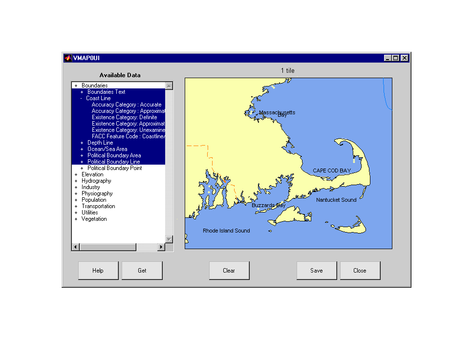
The highest resolution global vector data available to the public is the Vector Map Level 0, or VMAP0. It comes on four inexpensive CDs that can be purchased from the U.S. Geological Survey. The vmap0ui graphical user interface makes it easy to select and extract data from the CDs. The following example shows how to start up the vmap0ui panel. You can then zoom in on the map to the area of interest and select layer from the list. Clicking the Get button then extracts the selected layers for that region. Here most of the boundary data has been extracted:
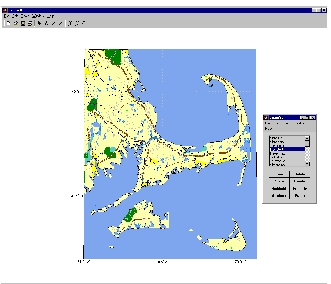
After extracting all of the desired data, you can save the result to a MAT-file, or return it to the workspace for display in another map axes. The data is stored in Geographic Data Structures, which contain enough information to allow the data to be displayed automatically. In the next figure, all of the geographic data for Cape Cod was extracted and saved in the MAT-file vmap0cape. The worldmap command creates a blank base map, and the mlayers panel is used to interactively display the data layer by layer. The equivalent actions at the command line would be to load the vmap0cape data and use the displaym command.
| | Displaying Data on a Base Map | Geographic Calculations | |