| Mapping Toolbox | |
Creating Vector Data
In addition to the vector map data available in the Mapping Toolbox and from external sources for such things as coastlines, political boundaries, and other more permanent objects, you may want to create your own vector data for such things as great circles, rhumb lines, and small circles.
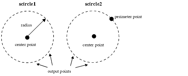
Calculating Small Circles
You can calculate vector data for points along a small circle in two ways. If you have a center point and a known radius, use scircle1; if you have a center point and a single point along the circumference of the small circle, use scircle2. For example, to get data points describing the small circle at 10° distance from (67°N, 135°W), use the following:
To get the small circle centered at the same point that passes through the point (55°N,135°W), use scircle2:
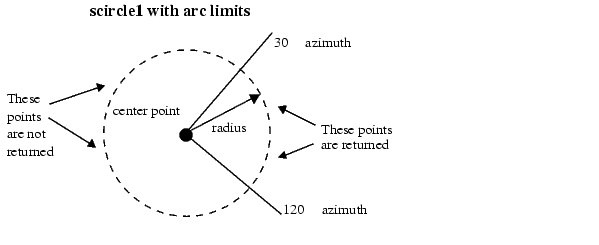
The scircle1 function also allows points along a specific arc of the small circle to be calculated. For example, if you want to know the points 10° in distance and between 30° and 120° in azimuth from (67°N,135°W), simply provide arc limits:
When an entire small circle is calculated, the data is in polygon format. For all calculated small circles, 100 points are returned unless otherwise specified. You can calculate several small circles at once by providing vector inputs. For more information, see the scircle1 and scircle2 functions in the online Mapping Toolbox reference documentation.
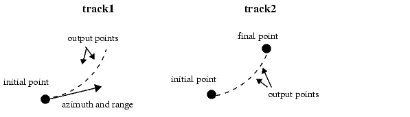
Calculating Tracks - Great Circles and Rhumb Lines
You can generate vector data corresponding to points along great circle or rhumb line tracks using track1 and track2. If you have a point on the track and an azimuth at that point, use track1. If you have two points on the track, use track2. For example, to get the great circle path starting at (31°S, 90°E) with an azimuth of 45° with a length of 12°, use track1:
For the great circle from (31°S, 90°E) to (23°S, 110°E), use track2:
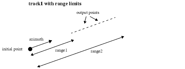
The track1 function also allows range endpoints to be specified. For example, if you want points along a rhumb line starting 5° away from the initial point and ending 13° away, at an azimuth of 55°, simply specify the range limits:
When no range is provided for track1, the returned points represent a complete track. For great circles, a complete track is 360°, encircling the planet and returning to the initial point. For rhumb lines, the complete track terminates at the poles, unless the azimuth is 90° or 270°, in which case the complete track is a parallel that returns to the initial point.
For calculated tracks, 100 points are returned unless otherwise specified. You can calculate several tracks at one time by providing vector inputs. For more information, see the track1 and track2 functions in the online Mapping Toolbox reference documentation. More vector path calculations are described later in the section,Navigation.
| | Merging Line Segments | Geographic Interpolation | |