| Mapping Toolbox | |
Project animated 2-D and 3-D comet plots on the current map axes
Activation
| Command Line |
Maptool |
| cometm comet3m |
Map Comet Comet |
Description
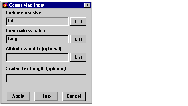
cometm and comet3m activate a Comet Map Input dialog box for projecting comet plots onto the current map axes.
If no map axes are current, a No Map Axes dialog box appears. Choose Yes to activate the Projection Control dialog box for defining map axes properties. Upon creation of the map axes, the Comet Map Input dialog box appears.
Controls
The Latitude variable edit box is used to specify the workspace variable containing the latitude data for the comet plot.
The Longitude variable edit box is used to specify the workspace variable containing the longitude data for the comet plot.
The Altitude variable edit box is used to specify the workspace variable containing the altitude data for the comet plot.
Pressing the List button produces a list of all current workspace variables, from which the latitude, longitude, and altitude variables can be selected.
The Scalar Tail Length edit box is used to enter a scalar value between 0 and 1 for the length of the comet tail. The default value is 0.1.
Pressing the Apply button accepts the input data and projects the comet plot onto the current map axes.
Pressing the Cancel button disregards any input data and closes the Comet Map Input dialog box.
| | colorm | contourm, contour3m | |