| Mapping Toolbox | |
Modify the properties of a displayed map
Syntax
setm(axishndl,PropertyName,PropertyValue,...)
setm(texthndl,'MapPosition',position)
setm(surfhndl,'Graticule',lat,lon,alt)
setm(surfhndl,'MeshGrat',npts,alt)
Description
setm(axishndl,PropertyName,PropertyValue,...) sets the properties of the map axes specified by its handle to the given values. The map properties must be recognized by axesm.
setm(texthndl,'MapPosition',position)alters the position of the projected text object specified by its handle to the [latitude longitude] or the [latitude longitude altitude] specified by the position vector.
setm(surfhndl,'Graticule',lat,lon,alt) alters the graticule of the projected surface object specified by its handle. The graticule is specified by the latitude and longitude matrices, specifying locations of the graticule vertices. The altitude can be specified by a scalar, or by a matrix providing a value for each vertex.
setm(surfhndl,'MeshGrat',npts,alt) alters the mesh graticule of projected surface objects displayed using the meshm command. In this case, the two-element vector npts specifies the graticule size in the manner described under meshm. The altitude can be a scalar or a matrix with a size corresponding to npts.
Examples
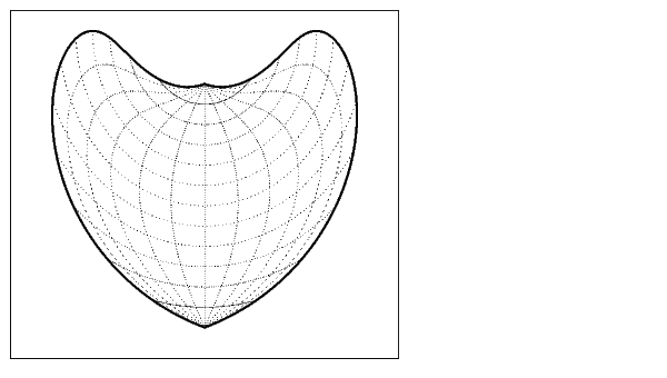
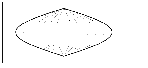
Display a map axes and alter it:
axesm('bonne','Frame','on','Grid','on')The standard Bonne projection has a standard parallel at 30°N.
Setting this standard parallel to 0° results in a Sinusoidal projection:
See Also
axesm |
Create and set map axes properties |
getm |
Get map object properties |
| | setltln | setpostn | |