| Mapping Toolbox | |
Working with the UTM projection
An important projection in scientific and surveying applications is the Universal Tranverse Projection, or UTM. The UTM projection divides the world into a regular grid of quadrangles, each 8 by 6 degrees in extent, called zones. Each zone uses formulas for a transverse version of the Mercator projection with projection and ellipsoid parameters designed to limit distortion. The UTM projection is defined between 80 degrees south and 84 degrees north. Outside these limits, the Universal Polar Stereographic (UPS) projection applies. The UPS has two zones, north and south, which also have special projection and ellipsoid parameters.
The easiest way to use the UTM projection is through graphical user interfaces. First create the map axes.
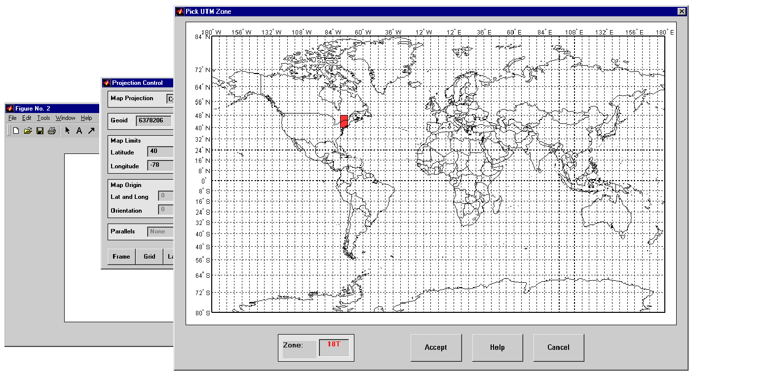
Then use the projection control panel to pick the zone for your area of interest. You can either extend-click on the map axes, or type axesmui to display the projection control panel. Click on the Zone button to open the utmzoneui panel. Click on the map near your area of interest to pick the zone.
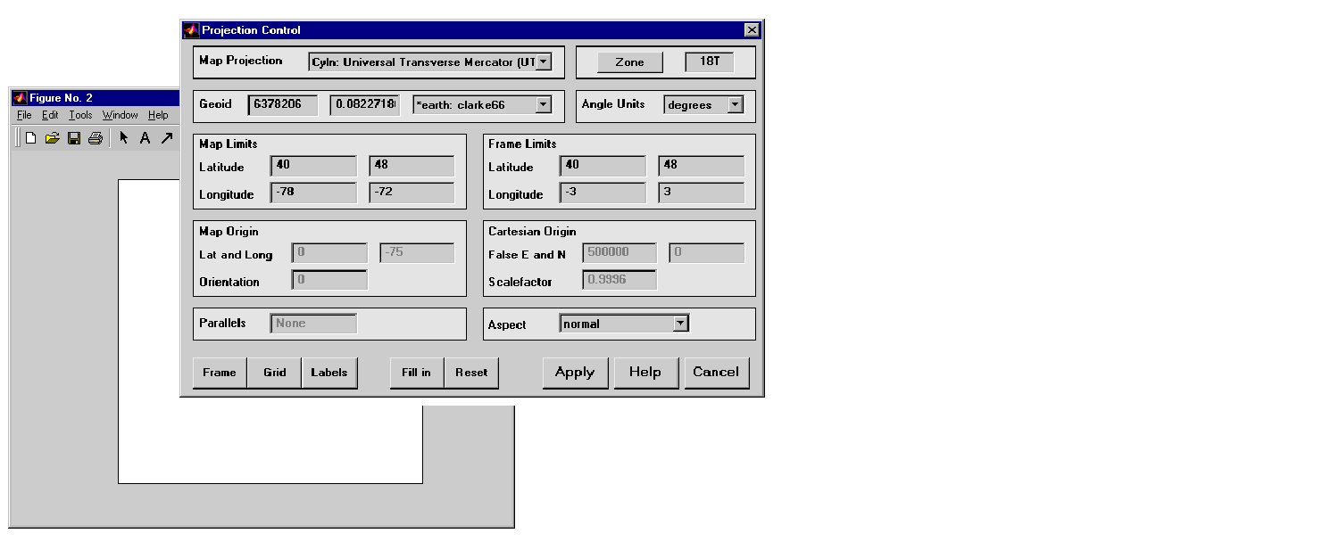
Clicking the Accept button closes the zone panel, and applies the chosen zone designation to the zone field. The geoid parameters are also automatically set to an ellipsoid definition that is recommended for that zone. You can override the default choice by selecting another ellipsoid from the list, or by typing the parameters in the Geoid field. Clicking Apply closes the projection control panel.
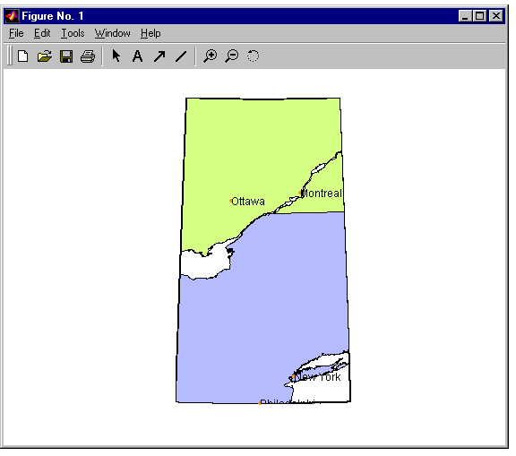
The projection is then ready for projection calculations or map display commands. Here is some basemap data from the worldlo and worldhi atlas data.
displaym(worldhi([40 48],[-78 -72]))
polcmap
framem
displaym(worldlo('PPpoint'))
displaym(worldlo('PPtext'))
trimcart alltext; tightmap
hidem(gca)l set(gcf,'color','w')
You can also calculate projected UTM grid coordinates from latitudes and longitudes.
Of course, you can set up a UTM projection to calculate coordinates without a map display. There are commands to help you pick the zone designation and an appropriate ellipsoid.
utmzone(40.5,-73.5)

ans =

18T

[ellipsoid,estr] = utmgeoid('18T')

ellipsoid =

    6378206.40          0.08


estr =

clarke66
Set up the UTM projection and calculate the grid coordinates without a map display.
close all
mstruct = defaultm('utm');
mstruct.zone = '18T';
mstruct.geoid = almanac('earth','geoid','m','clarke66');
mstruct = defaultm(utm(mstruct));
[x,y] = mfwdtran(mstruct,40.5,-73.5)

x =

     627106.47


y =

    4484124.43
To display areas that extend across more than one UTM zone, it may be more appropriate to use the Mercator projection with parameters that make it transverse. Here is an example of a transverse Mercator projection appropriate to Chile. Note how the projection's line of zero distortion is aligned with the predominantly north-south axis of the country. The zero distortion line could be put exactly on the midline of the country by a better choice of the origin vector's central meridian and orientation angle.
latlim = [-60 -15];centralMeridian = -70; width = 20;
axesm('mercator',...
    'Origin',[0 centralMeridian -90],...
    'Flatlimit',[-width/2 width/2],...
    'Flonlimit',sort(-latlim),...
    'Aspect','transverse')
displaym(worldlo('POline'));framem
gridm; setm(gca,'plinefill',1000)
tightmap
mdistort scale
| | Working with the Globe Projection | Summary Guide | |