| Mapping Toolbox | |
Geometric Surfaces
Three standard types of geometric surfaces are used to develop map projections: the cylinder, the cone, and the plane. A few projections, however, cannot be categorized as such, or are combinations of these. The three classifications are used for a wide variety of projections, including some that are not geometrically constructed.
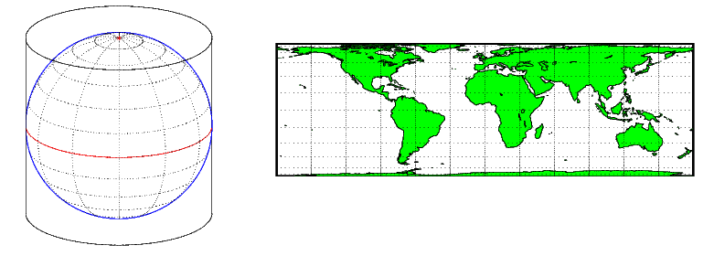
A cylindrical projection is produced by wrapping a cylinder around a globe representing the Earth. The map projection is the image of the globe projected onto the cylindrical surface, which is then unwrapped into a flat surface. Parallels appear as horizontal lines and meridians as vertical lines. The following shows a regular cylindrical or normal aspect orientation in which the cylinder is tangent to the Earth along the Equator and the projection is calculated horizontally from the axis.
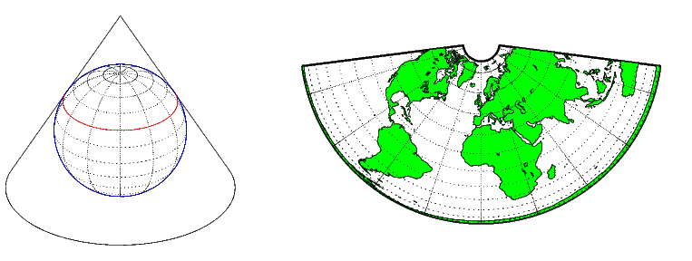
A conic projection is derived from the projection of the globe onto a cone placed over it. For the normal aspect, the apex of the cone lies on the polar axis of the Earth, and the surface of the cone touches the globe along a particular parallel of latitude. A polyconic projection considers each band of parallels as part of separate cones, each tangent to the globe at that particular parallel latitude.
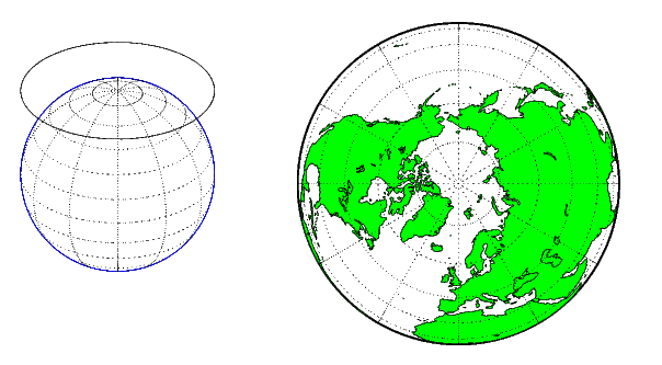
An azimuthal projection is a projection of the globe onto a plane. For a polar azimuthal projection, the plane is tangent to the Earth at one of the poles, with meridians projected as straight lines radiating from the pole, and parallels shown as complete circles centered at the pole.
Each of these projection types can be further modified:
| | Quantitative Properties | Projection Aspect | |