| Mapping Toolbox | |
Add graphic element pointing to the geographic North Pole
Syntax
Description
northarrow creates a north arrow symbol at the map origin on the displayed map. The north arrow symbol can be repositioned by clicking and dragging its icon. Alternate clicking on the icon creates an input dialog box that can be also to change the location of the north arrow.
northarrow('property',value,...) creates a north arrow using the specified property-value pairs. Valid entries for properties are 'latitude', 'longitude', 'facecolor', 'edgecolor', 'linewidth', and 'scaleratio'. The 'latitude' and 'longitude' properties specify the location of the north arrow. The 'facecolor', 'edgecolor', and 'linewidth' properties control the appearance of the north arrow. The 'scaleratio' property represents the size of the north arrow as a fraction of the size of the axes. A 'scaleratio' value of 0.10 will create a north arrow one-tenth (1/10) the size of the axes. The appearance ('facecolor', 'edgecolor', and 'linewidth') of the north arrow can be changed using the SET command.
Modifying some of the properties of the north arrow will result in replacement of the original object. Use HANDLEM('NorthArrow') to get the handles associated with the north arrow.
Examples
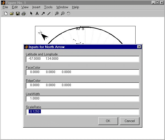
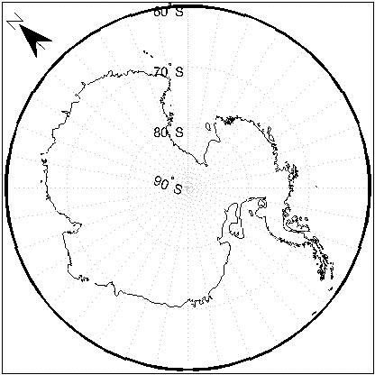
Create a map of the South Pole and then add the north arrow in the upper left of the map.
Alternate (right) click on the north arrow icon to activate the input dialog box. Increase the size of the north arrow symbol by changing the 'ScaleRatio' property.
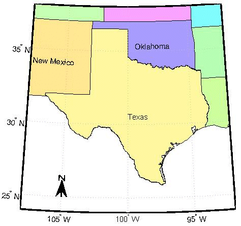
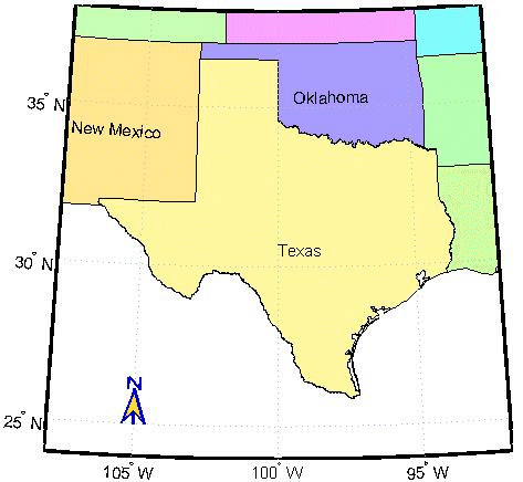
Create a map of Texas and add the north arrow in the lower left of the map.
Change the 'FaceColor' and 'EdgeColor' properties of the north arrow.
h = handlem('NorthArrow');
set(h,'FaceColor',[1.000 0.8431 0.0000],'EdgeColor',[0.0100
0.0100 0.9000])
Limitations:
Multiple north arrows may be drawn on the map. However, the callbacks will only work with the most recently created north arrow. In addition, since it can be displayed outside the map frame limits, the north arrow is not converted into a 'mapped' object. Hence, the location and orientation of the north arrow has to be updated manually if the map origin or projection is changed.
| | nm2deg, nm2km, nm2rad, nm2sm | npi2pi | |