| Mapping Toolbox | |
Buffer Zones
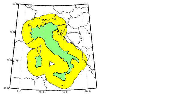
A buffer zone is the area within a certain distance of a set of points. For a closed polygon, the buffer zone is defined as the locus of points that are a certain distance in or out of the polygon. A buffer zone for an open polygon is the locus of points a certain distance out from the polygon. The bufferm command computes the buffer points by placing small circles at the vertices of the polygon and rectangles on the line segments, and applying the appropriate polygon boolean operation.
If the outline of Italy were saved in NaN-clipped latitude and longitude vectors, you could compute the set of points that are a distance of 1.5 degrees out from the coast:
| | Cutting Polygons at the Dateline | Trimming Vector Data to a Defined Region | |