| Mapping Toolbox | |
Segments Versus Polygons
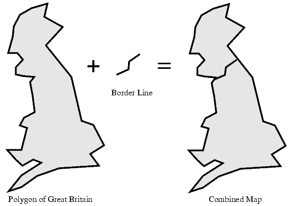
Geographic objects represented by vector data may or may not be formatted as polygons. Imagine two variables, latcoast, and loncoast, which correspond to sequential points around the coast of the island of Great Britain. If this data returns to its starting point, then a polygon-formatted map of Great Britain exists. This data might be plotted as a patch or as a line, and it might be logically employed in calculations as either.
Now consider two more variables, latborder and lonborder, which correspond to points along the Anglo-Scottish border, proceeding from the west coast at Solway Firth to the east coast at Berwick-upon-Tweed. This data can really only be plotted as a line. The two pairs of variables together can form a map. They can be displayed as a patch of Great Britain with a line showing the border. However, you still would not have a polygon-formatted map of Scotland alone.
| | Working with Vector Maps | Extracting Polygon or Line Segments | |