| Mapping Toolbox | |
Interactive Tracks and Circles
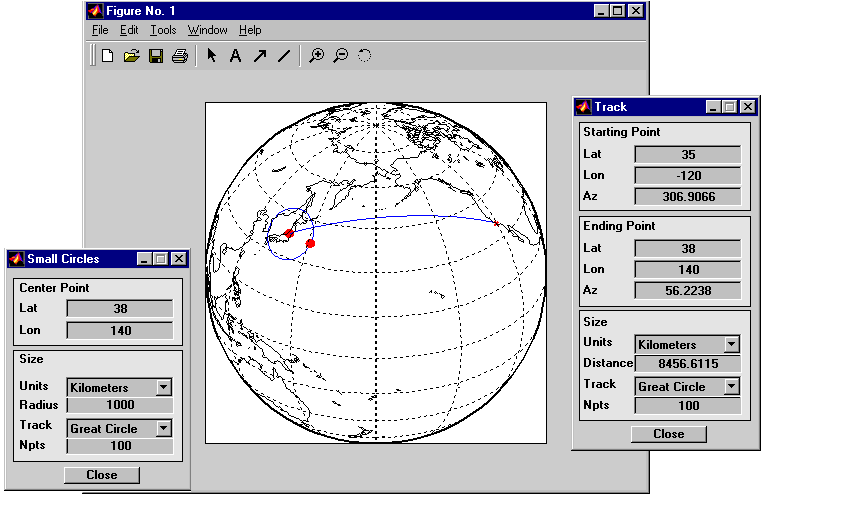
Geographic line data such a great circle tracks and small circles can also be calculated or created interactively. Great circle tracks are the shortest distance between points, and small circles are the locus of points a constant distance from a center point. You can use trackg and scircleg to create them by clicking on the map. If you extend-click on the tracks or circles, you can move the control points to modify the lines, or type specific numbers into a control panel. The control panels also allow the tracks and circles to be used for measurements on the map. Just adjust the lines or circles to the right place on the map, and read the dimensions off the control panel.
Here are a great circle track from the United States to Japan and a 1000 km radius small circle centered on Tokyo. The track and circles were created by clicking on the map at approximately correct positions, then extend-clicking on the track and circle to bring up the control panels. The exact numbers were entered into the control panels for the final result.
| | Interacting with Displayed Maps | Interactive Text | |