| Mapping Toolbox | |
Camera position in geographic coordinates
Syntax
Description
camposm(lat,long,alt) sets the axes CameraPosition property of the current map axes to the position specified in geographic coordinates. The inputs lat and long are assumed to be in the angle units of the current map axes.
[x,y,z] = camposm(lat,long,alt) returns the camera position in the projected Cartesian coordinate system.
Examples
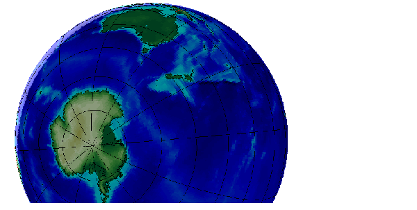
Look at northern Australia from a point south and one Earth radius above New Zealand:
figure; axesm('globe','galt',0); gridm('glinestyle','-')
load topo; meshm(topo,topolegend,size(topo)); demcmap(topo)
displaym(worldlo('POline'))
camlight; material(0.6*[ 1 1 1])
plat = -50; plon = 160; tlat = -10; tlon = 130;
camtargm(tlat,tlon,0); camposm(plat,plon,1); camupm(tlat,tlon)
set(gca,'CameraViewAngle',75)
See Also
camtargm |
Camera target from geographic coordinates |
camupm |
Camera UpVector from geographic coordinates |
campos |
Camera position |
camva |
Camera view angle |
| | bufferm | camtargm | |